
Philip's Street Atlas Buckinghamshire: Philip's Street Atlas - Travel Book
Philip's Street Atlas Buckinghamshire
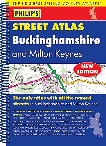
Author: Philip's MapsPublisher: Philip'sCategory: Travel, Maps- The only atlas with all the named streets in Buckinghamshire.- Updated edition for 2018 with new business parks and estates added.- From Philip's, the UK's leading publisher of county street atlases.- Street maps show car parks, schools, hospitals and many other places of interest. - Practical route-planning section showing all A and B roads.AYLESBURY, BLETCHLEY, CHESHAM, HIGH WYCOMBE, MILTON KEYNES, SLOUGH, Amersham, Beaconsfield, Berkhamsted, Buckingham, Burnham, Chalfont St Giles, Chalfont St Peter, Chesham Bois, Chorleywood, Cookham, Denham, Flackwell Heath, Gerrards Cross, Great Missenden, Haddenham, Hazlemere, Iver, Linslade, Little Chalfont, Loudwater, Loughton, Maidenhead, Marlow, Newport Pagnell, Olney, Prestwood, Princes Risborough, Stoke Mandeville, Stoke Poges, Stony Stratford, Thame, Tring, Uxbridge, Wendover, Windsor, Winslow, Wolverton.This fully updated Philip's street atlas of Buckinghamshire and Milton Keynes gives comprehensive and detailed coverage of the region in a convenient spiral-bound format. The route planner shows all the A and B roads, and can be used when driving to get close to the destination before turning to the relevant large-scale street map.The street maps show every named road, street and lane very clearly, with major roads picked out in colour. The maps are at a scale of 3.5 inches to 1 mile. The comprehensive index lists street names and postcodes, plus schools, hospitals, railway stations, shopping centres and other such features picked out in red, with other places of interest shown in blue.Philip's Street Atlas Buckinghamshire and Milton Keynes is suitable for both business and leisure use.
About Philip's Maps
Philip's has been at the forefront of creating maps and atlases since 1834. Whether a local street map or a fact-packed World Atlas, we use the most up-to-date technology, expertise and our global network to ensure our customers have all the information they need.| SKU | BK-9781849074506 |
| Barcode # | 9781849074506 |
| Brand | Philip's |
| Artist / Author | Philip's Maps |
| Shipping Weight | 0.4000kg |
| Shipping Width | 0.200m |
| Shipping Height | 0.020m |
| Shipping Length | 0.260m |
| Assembled Length | 26.300m |
| Assembled Height | 1.500m |
| Assembled Width | 19.500m |
